We present obstacleanalyze.com with its new interface and services
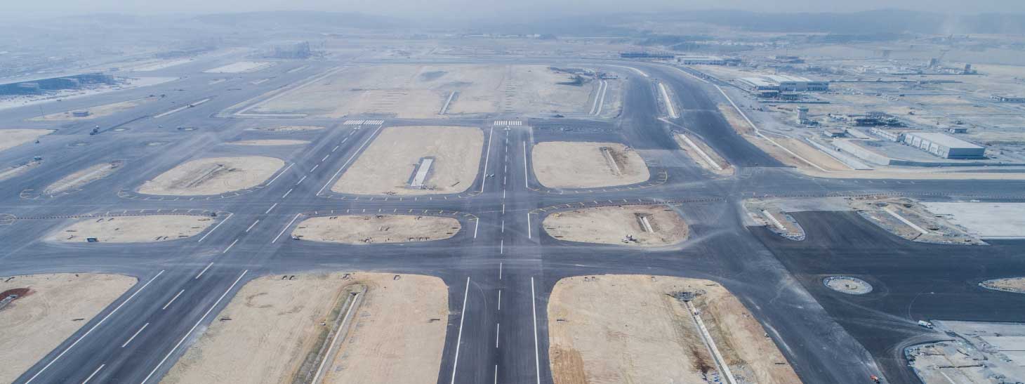
Airport Imaginary Surfaces included in Public Zoning Plans of Municipalities

ObstacleAnalyze.com Your Door to Aeronautical Information which have been Developed in Compliance with Civil Aviation Authorities (CAA) and State Airports Authorities (SAA) Regulations
Have you considered the AIS elevations while calculating Hmax and Precedent? Which Functions Are Allowed Around Airports and Where
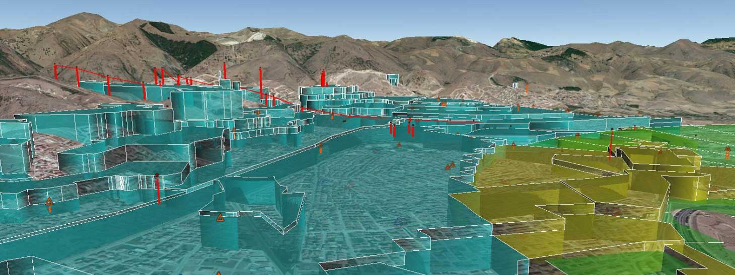
Airport Height Map – Local Zoning Analysing of CNS Equipment

Since 2016, Obstacle Analyze has been developing a system using national resources, international standards, and platforms in the context of "obstacle analysis software."
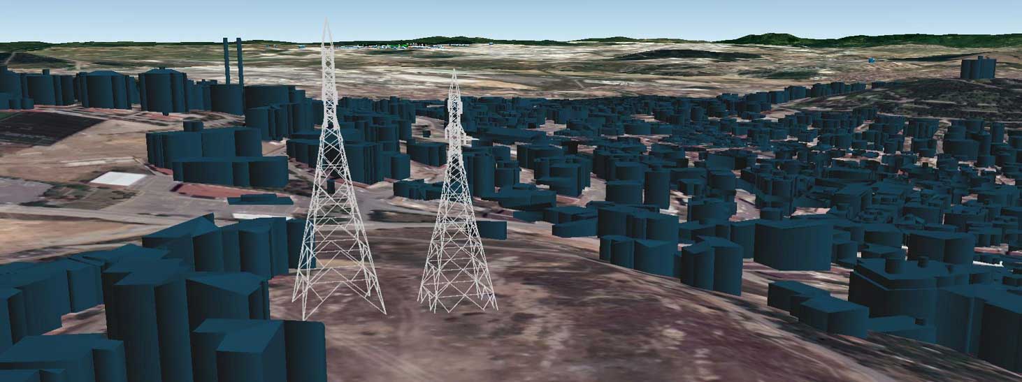
Aviation authorities and airport operators in Turkey and around the world are authorized and responsible for developing, protecting, and monitoring elevation restrictions in airport imaginary surfaces. Access to obstacle information is critical for individuals and/or organizations seeking to develop plans, projects, or begin construction in the real estate surrounding airports. Using ObstacleAnalyze, which also holds Technological Product Experience and Trademark Registration Certificates, aviation information in FAA standards can be queried online, such as which building functions and how many meters of building permits can be granted around airports.

As ObstacleAnalyze team, we are always striving for better and adding value to the aviation industry with our unique and innovative products.
We produce information worldwide..
We produce solutions for municipalities, landlords and institutions.
We're following up on developments.
We're doing analysis according to the standards set by their authority.
We have a multidisiplinary team structure.
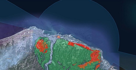
The most convenient way for landowners, contractors, and investors to access obstruction data. Determine the value of your property based on where it is on the Airport Imaginary Surface. Municipalities' public zoning plans include airport imaginary surfaces.
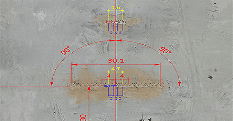
Which functions are permitted near airports, and where are they permitted? Have you taken the AIS elevations into account when calculating Hmax and precedent? ObstacleAnalyze.com is your gateway to FAA-compliant aeronautical information. International projects are developed in accordance with the directives of the Turkish Civil Aviation Directorate General (DGCA) and the General Directorate of State Airports Authority.

The first 5 queries are free.
For Point, Each Subsequent click costs 100$.
$200 for a building query.

Point Query
View and Query
Airport Imaginary
Surfaces
Add
Obstruction
Technical
Support
For More Information, You Can Contact Us.
The Membership System is for You to Access Your Queries Again.
You can view and analyze the previous obstruction that you added. You can get answers to your questions, such as which surface is your obstruction and how much the amount of infringement is on that surface.